


Mayewood Voting District, Sumter County, South Carolina
About
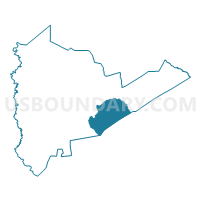
Outline

Summary
| Unique Area Identifier | 666842 |
| Name | Mayewood Voting District |
| County | Sumter County |
| State | South Carolina |
| Area (square miles) | 46.41 |
| Land Area (square miles) | 46.41 |
| Water Area (square miles) | 0.00 |
| % of Land Area | 100.00 |
| % of Water Area | 0.00 |
| Latitude of the Internal Point | 33.85692750 |
| Longtitude of the Internal Point | -80.23644590 |
Maps


Graphs
Select a template below for downloading or customizing gragh for Mayewood Voting District, Sumter County, South Carolina


Neighbors
Neighoring Voting District (by Name) Neighboring Voting District on the Map
- Alcolu Voting District, Clarendon County, SC
- Home Branch Voting District, Clarendon County, SC
- Mayesville Voting District, Sumter County, SC
- Pocotaligo #1 Voting District, Sumter County, SC
- Salem Voting District, Sumter County, SC
- Turkey Creek Voting District, Sumter County, SC
Top 10 Neighboring County Subdivision (by Population) Neighboring County Subdivision on the Map
- Privateer CCD, Sumter County, SC (12,046)
- Sumter Southeast CCD, Sumter County, SC (4,168)
- Sumter Northeast CCD, Sumter County, SC (2,818)
- Paxville CCD, Clarendon County, SC (2,503)
- Shiloh CCD, Sumter County, SC (2,349)
- Alcolu CCD, Clarendon County, SC (2,264)
Top 10 Neighboring Unified School District (by Population) Neighboring Unified School District on the Map
Top 10 Neighboring State Legislative District Lower Chamber (by Population) Neighboring State Legislative District Lower Chamber on the Map
- State House District 67, SC (36,320)
- State House District 60, SC (34,706)
- State House District 64, SC (34,361)
Top 10 Neighboring State Legislative District Upper Chamber (by Population) Neighboring State Legislative District Upper Chamber on the Map
Top 10 Neighboring 111th Congressional District (by Population) Neighboring 111th Congressional District on the Map
Top 10 Neighboring Census Tract (by Population) Neighboring Census Tract on the Map
- Census Tract 4, Sumter County, SC (8,538)
- Census Tract 19.02, Sumter County, SC (5,673)
- Census Tract 6, Sumter County, SC (4,168)
- Census Tract 9604, Clarendon County, SC (2,503)
- Census Tract 5, Sumter County, SC (2,349)
- Census Tract 9603, Clarendon County, SC (2,264)
Top 10 Neighboring 5-Digit ZIP Code Tabulation Area (by Population) Neighboring 5-Digit ZIP Code Tabulation Area on the Map
- 29150, SC (40,031)
- 29102, SC (18,248)
- 29153, SC (15,633)
- 29001, SC (2,148)
- 29104, SC (1,531)
- 29051, SC (951)